This project is made possible in part by Library Services and Technology Act (LSTA) funds from the U.S. Institute of Museum and Library Services and through the Commonwealth of Pennsylvania's Library Access funds administered by the Pennsylvania Department of Education, Office of Commonwealth Libraries. The views, findings, conclusions, or recommendations expressed in this website do not necessarily represent those of the U.S. Institute of Museum and Library Services or the Pennsylvania Department of Education.
Hosted by HSLC.
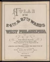
![Caldwell's illustrated, historical, centennial atlas of Washington Co., Pennsylvania. From actual surveys by & under the directions of J.A. Caldwell, assisted by C.T. Arms, Sr. [and others] E. Bott, artist](https://digitalarchives.powerlibrary.org/papd/sites/papd/files/styles/islandora_imagecache_image_style_medium/public/externals/0f3607c6f3f4fcd7fe98d3477cc7c3e0.jpg?itok=GHzim7vg&pid=papd:sstlp-temp_33270&iic=true)
